Hydros Remote Control
Remote control and management of farmers with irrigation rights and water collection and distribution networks
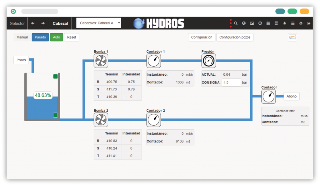
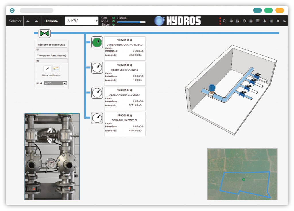
Hydros is a remote control and management system for irrigation communities and water collection and distribution networks. The system allows for the automation, remote control and real-time management of the irrigation communities and water collection and distribution networks. It includes planning by time and/or volume, and an alarm and alert system that optimises response times to breakdowns and improves maintenance, as well as providing consumption information for subsequent billing. The system has been developed using current technologies and the client is a web browser. It enables connection to farmers with irrigation rights themselves, to view consumption in real time and even set alarms and irrigation schedules.

Management of automation networks for adequate supervision and management
Geographic Information System (GIS) integration
Communication with field equipment through different protocols and technologies
Real-time display and browsability of signals and data
Planning management, by time and volume, at all hierarchy levels
User and role management (security and authentication)
Predefined and configurable calculation and graphics module
Export of reports and historical data in Excel and PDF format
Alert manager (e-mail, SMS, screen, etc.)
Integration with other systems through API REST
Farmers / citizens portal
Adaptive graphic design
Built-in SEPA and publishing of invoices to the cloud (Docucloud)
+35
IMPLEMENTATIONS
In municipalities in the Balearic Islands and Catalonia, and the autonomous communities of Valencia, Aragon, Catalonia and Navarre.
SCALABLE
TECHNOLOGY PLATFORM
Capacity and dimension of work are always adjusted to customers needs, without affecting to the quality and the efficiency of the result.
GIS
GEOGRAPHIC INFORMATION SYSTEM
Remote control and management system integrated with a geographic information system


